I’ve been dreaming of climbing Mount Hood since gazing at this angular, gorgeous peak from across the stateline on Mount Adams. The shape of it struck me – so distinct from the cone mountain tops of Mount Rainier, Mount Adams, and Mount Adams that speckle the Washington skyline. Mount Hood with it’s headwall seeming to shoot vertically into the clouds was mesmerizing and intimidating.
As the winter settled in, I was so anxious to climb Mount Hood that I simply didn’t want to wait till spring and figured this seemed like as good an opportunity to test my chops at winter mountaineering as ever, so set my sights on a winter climb. Right at the end of February, the stars aligned with a high pressure system bringing clear skies and low winds.
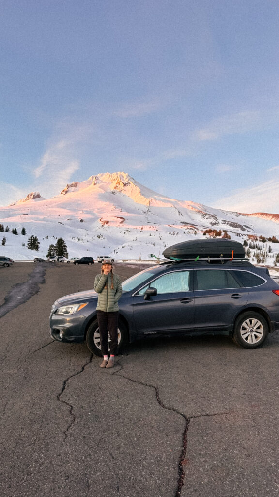
We spent the night before at the Timberline parking lot. A T.V. show production was set up with many massive buses at the climber’s parking lot, so we instead tried to be as stealthy as we could cooking up dinner in the ski resort parking lot and crawling into bed around 7pm.
Our 1am alarms went off too soon. But, unlike some alpine starts, I had managed to get a refreshing 5 hours of sleep. When we peeked outside, the parking lot was deserted and dark with no moon to be seen. I supposed we would be going it alone.
We started off from the parking lot at 1:50am. The section from Timberline parking lot to the top of Palmer lift is simply a slog. A steep slog. The wind was blowing hard from the west, and the snow and ice crystals irritated my left eye, but there was really no way to turn away from it as the only way to go was straight up.
We reached the Devil’s Kitchen at about 6am, just as first light was starting to illuminate the mountain enough that we could seek the shapes around us. We were surprised that there was a couple large crevasse cracks in the Devil’s Kitchen, which we didn’t expect in February. We took care in navigating these. We could see a smattering of headlamps down on the mountain from climbers who had gotten up at a semi more reasonable time.
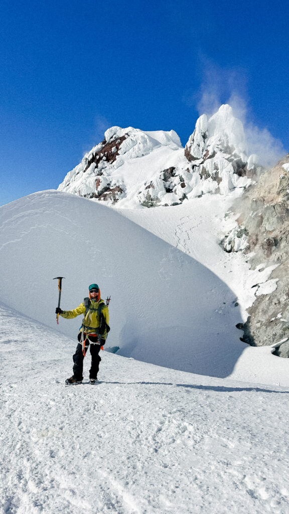
The smell from the volcanic fumaroles in the Devil’s Kitchen areas was strong, as I’d notoriously heard. We stopped to stuff lara bars down our gullets in this area and luckily the gusts of wind kept the smell from being too strong.
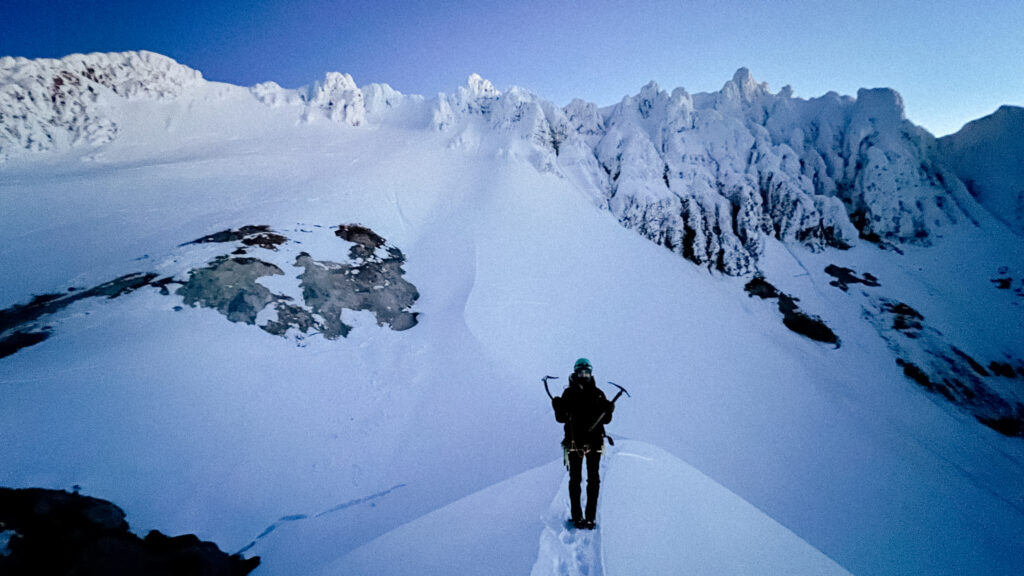
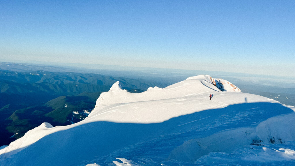
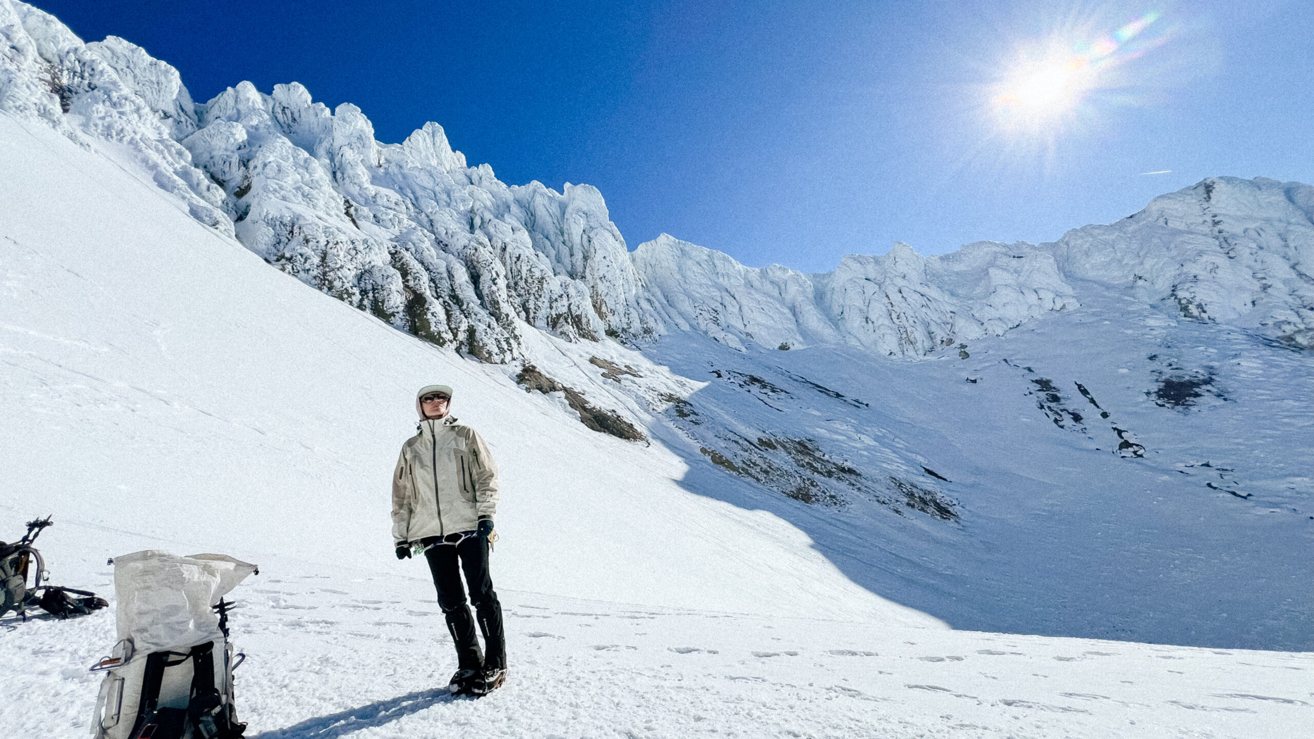
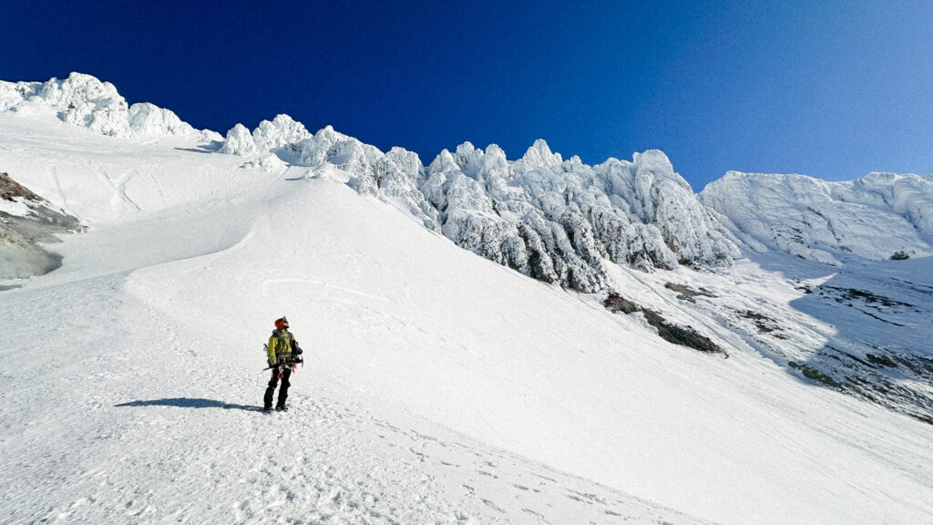
The climb out of Devils Kitchen was the start of steep snow climbing and gave good information for the headwall that would come next. There was a significant ice crust that necessitated forceful steps and swings for the crampon to grab in the hard surface. On top of Hogsback – a significant ridge feature formed by wind and the steam from the nearby fumaroles – we got a look at our route up the headwall. It looked steep.
Feeling a bit puckered, we started climbing. The climb challenged me. Quickly, my arms and legs started to tire from the force needed to gain purchase in the ice with my ice tools and frontpointing. But there really wasn’t anywhere to stop and rest and a look down provided the comforting notion that a slip would probably send you sliding into the steaming fumarole at the bottom of the headwall. Onward.
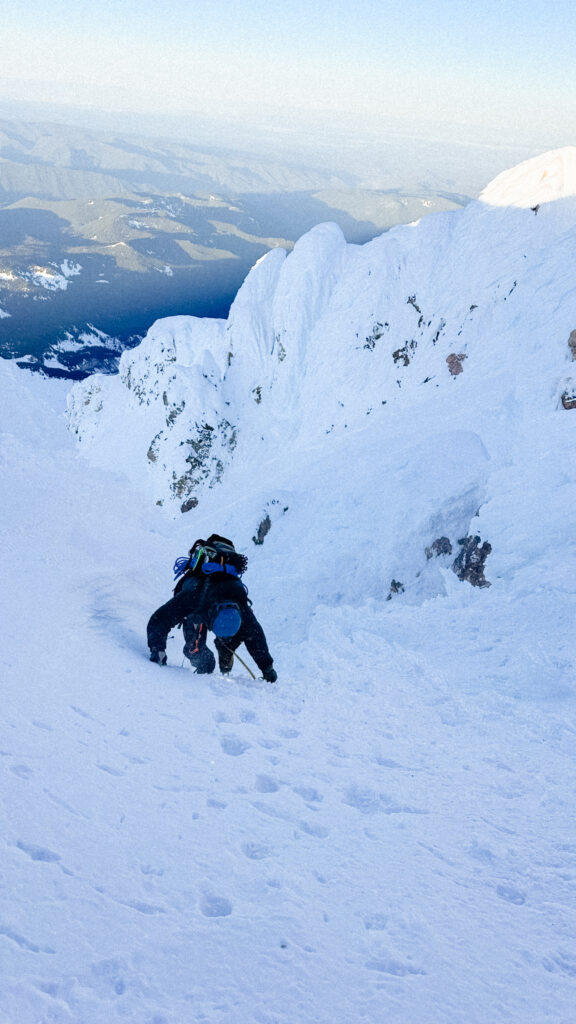
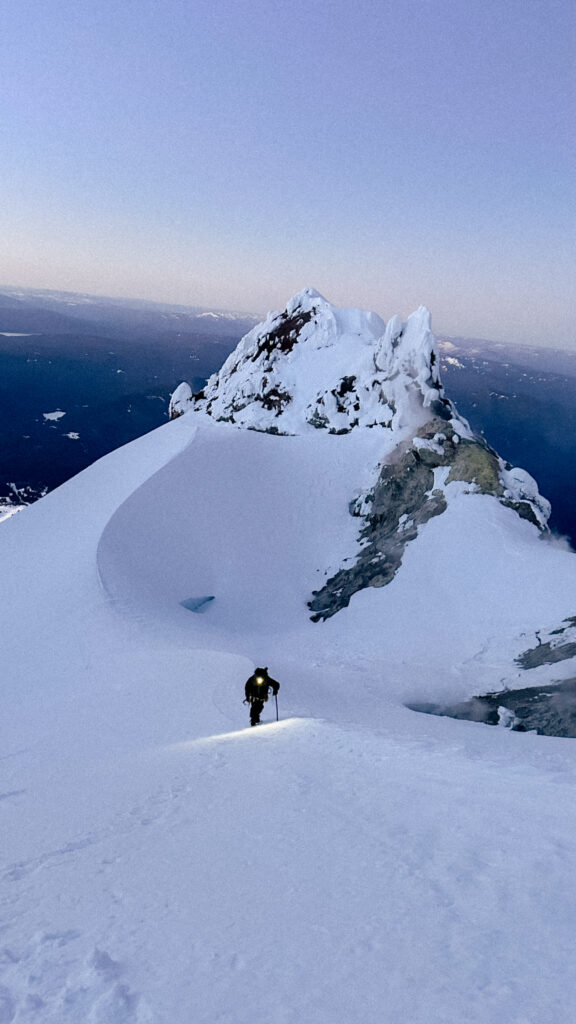
About halfway up this section, I started getting intense cramps in my legs and found myself totally humbled, gripping both my ice tools with all I had and dragging myself the last 600ft up the headwall with more grunting than I’d care to admit. The top section of Mazama Chute the cherry on top of the challenge with thick blue ice in some areas and exposed rock in others.
When I reached the top of the chute, I stood with the bitter cold wind drying the tears on my cheeks and a wide grin – all the pain and strife I had just experienced on the headwall forgotten. I reckon sometimes with how ridiculous it is that this is how I choose to spend my free time, but I truly cannot imagine wanting it any other way.
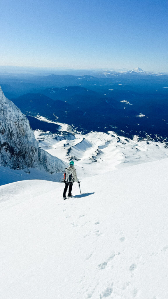
Due to the wind, we spent only a few minutes on the summit taking in the clear views of Rainier, Adams, Mount St Helens, Mount Jefferson, and the Three Sisters beyond. I down some water and some extra salt gummy chews in hopes to stave off the cramps on the climb down.
Groveling down the headwall took even longer than upclimbing it seemed, especially since on the last halfway down the sun hit us, instantly setting us ablaze in our puffy coats and seemingly almost instantaneously causing the ice on the upper mountain to weaken as chunks of ice – thankfully small – starting fall from the ice outcroppings above. I kept my head down and caught a couple small ice chunks on my arms which hurt more than I expected. Luke got a still small but larger chunk to the chest causing him to yell out. We stepped up the pace to get off the upper mountain before the solar warming caused more significant icefall. Of all the trip reports I’ve heard, ice fall seems to be the most prevalent hazard on the upper mountain. Many, many climbers each year get injured from a chunk of falling ice on this section or get hit by ice fall that causes them to have a long, sliding fall down the 1000 ft of the headwall. Avoiding the solar warming that worsens this hazard was the reason for our 2am start.
Relieved upon reaching Hogsback, we shedded layers and took a long break to take in the beauty of this place that we now felt hesitant to leave. Eventually it was time to make our way down the mountain.

Between Devil’s Kitchen and the top of Palmer, we ran into several groups on their way up – they seemed to think we were a little bonkers for heading up so early and I certainly thought they were a little bonkers for heading up so late with all the ice fall that was already underway at only 9am on this unusually warm February day.
We reached the parking lot at around 12:30pm and headed straight to Koya Kitchen – the best place to eat in Portland to the Government Camp area. A meal of Koya’s miso-yuzu fries and fried rice and a lay in their outdoor hammocks was just what the doctor ordered after our night/morning.
Grateful for the safe passage on this truly larger than life mountain.
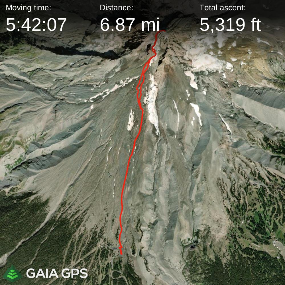
Route & Beta
- Date climbed: February 28, 2025
- Route: South side via Mazama Chute. Starts at Timberline parking lot. See below for map and Gaia Maps link.
- Hazards: The primary concerns for this route are icefall and avalanche danger. We mitigated avalanche risk by carrying avalanche equipment, made our day with moderate avalanche risk from the Northwest Avalanche Center, and had an agreement to turn around if we encountered danger signs. To mitigate icefall hazard, we planned to climb early, primarily before the sun would hit the south side of the mountain. A 1:50 am start from the trailhead put us on the summit around 8am. The headwall climb was slow and tedious, and it was good not need rush this section on the way up due to falling ice. We took a lot of snack breaks to take in the nice weather and views on the way down and reached the car at 12:30pm. This section could definitely be a lot faster than we took it.
- Weather: I religiously checked and cross-referenced NOAA point forecast and mountain forecast for weeks to determine our climb window.
See more on our route in Gaia Maps here.